Krastets
Krastets
Кръстец | |
|---|---|
Village | |
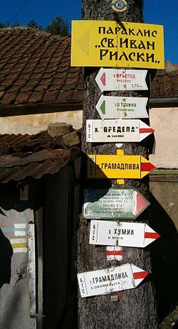
 Trail signage in Krustets | |
| Country | |
| Province | Gabrovo Province |
| Municipality | Tryavna |
| Elevation | 896 m (2,940 ft) |
| Time zone | UTC+2 (EET) |
| • Summer (DST) | UTC+3 (EEST) |
Krustets (Bulgarian: Кръстец [krɐsˈtɛt͡s]) is a village in Tryavna Municipality, in Gabrovo Province, in northern central Bulgaria.[1] It is located at an elevation of around 900 metres (3,000 ft), not far from the summit of the Balkan Mountains. The long-distance Kom–Emine hiking trail passes by the village.
References
- ^ Guide Bulgaria, Accessed May 24, 2010
42°46′N 25°34′E / 42.767°N 25.567°E

